374.07± ACRES
Elsie and Arthur Rahn Trust
Mountain Lake Township, Cottonwood County, Minnesota
Sold - Farm Auction
Friday, November 21, 2025 @ 2:30 p.m.
Location:
Mountain Lake Community Center
1027 Second Avenue, Mountain Lake, MN 56159
Owner: Elsie J. Rahn Revocable Trust and Arthur Rahn Trust B
Trustees: Lois Marschinke and Lee Suderman
Attorney: Greg Olson, Patton, Hoversten & Berg Law Office
- Agent Name:
- Chuck Wingert
- Agent Phone:
- 507.381.9790
- Agent Email:
- charles@wingertlandservices.com

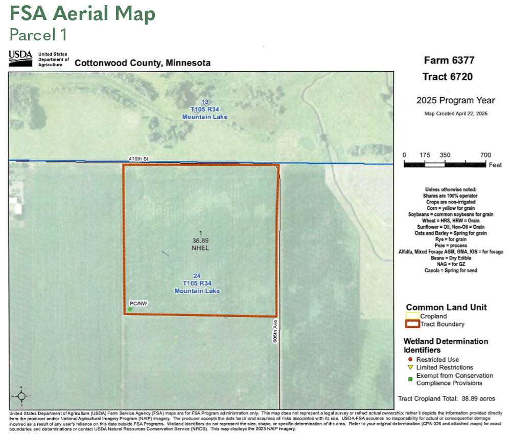
TAX ID #: 120240200
REAL ESTATE TAXES: 2025 Ag Non-Homestead Taxes - $2,176.00 Special Assessment - $0.00 Total Estimated Tax & Specials - $2,176.00
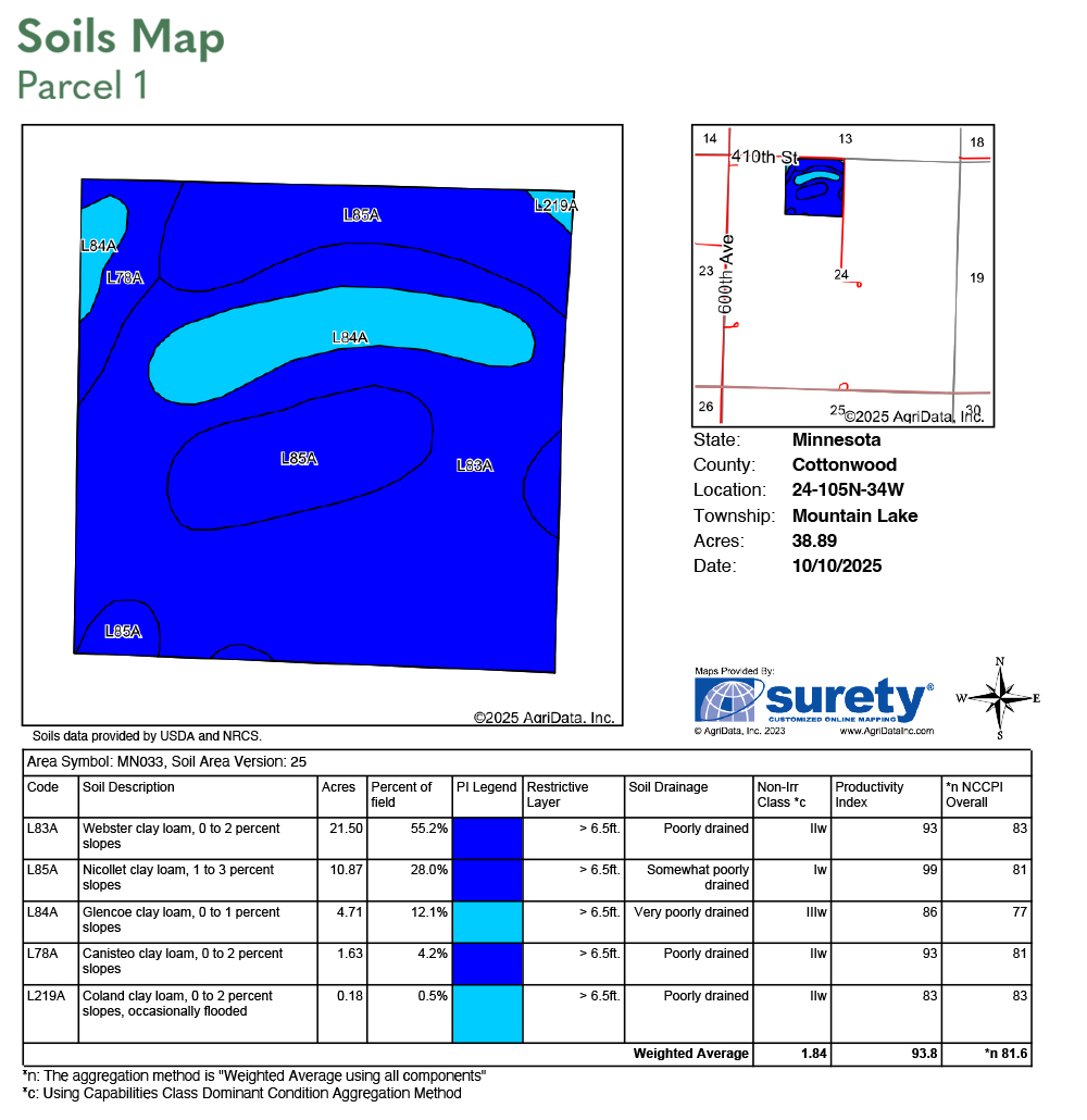
FSA INFORMATION: Total Acres - 40.00± acres FSA Tillable Acres - 38.89± acres Corn Base Acres - 19.40± acres Corn PLC Yield - 167.00± bushels Soybean Base Acres - 19.40± acres Soybean PLC Yield - 41.00± bushels
LAND LEASE & WIND EASEMENT INFORMATION: The Rahn trustees entered into a land lease and wind easement with Geronimo Wind Energy, LLC, in July of 2011. The 2025 payment was $20.00 per acre ($800.00). A copy of the land lease and wind easement, along with accompanying documents, will be furnished upon request.
SOIL DESCRIPTION: Nicollet clay loam, Webster clay loam, Glencoe clay loam, Canisteo clay loam, Coland clay loam. See soil map.
CROP PRODUCTIVITY INDEX (CPI): 93.8 CPI
TOPOGRAPHY: Level to slight roll.
DRAINAGE: Private outlet to creek - random laterals. No tile maps were available.
CRP: N/A
NRCS CLASSIFICATION ON TILLABLE ACRES: PC/NW – Prior Converted/No Wetlands NHEL – No Highly Erodible Lands
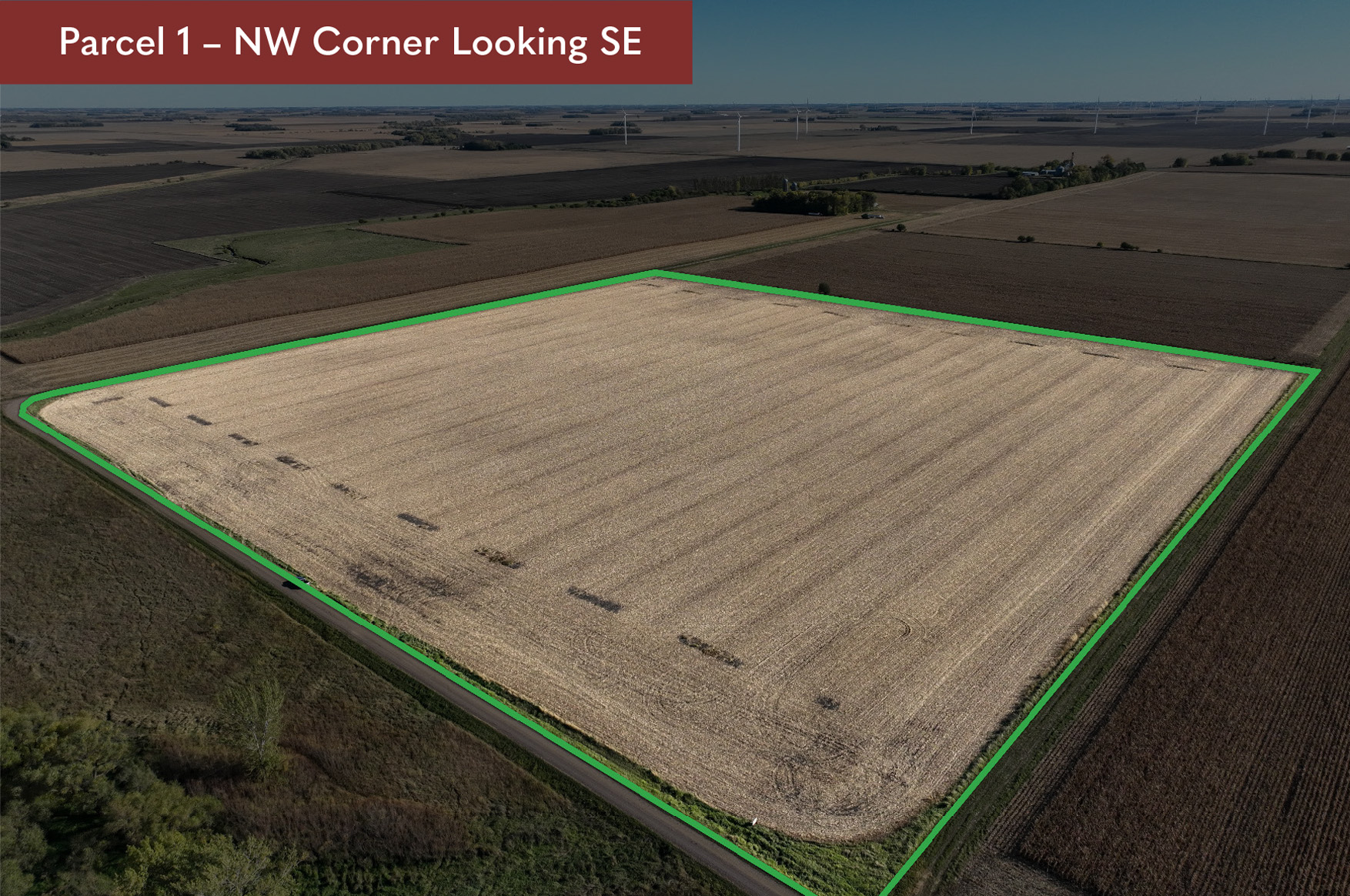
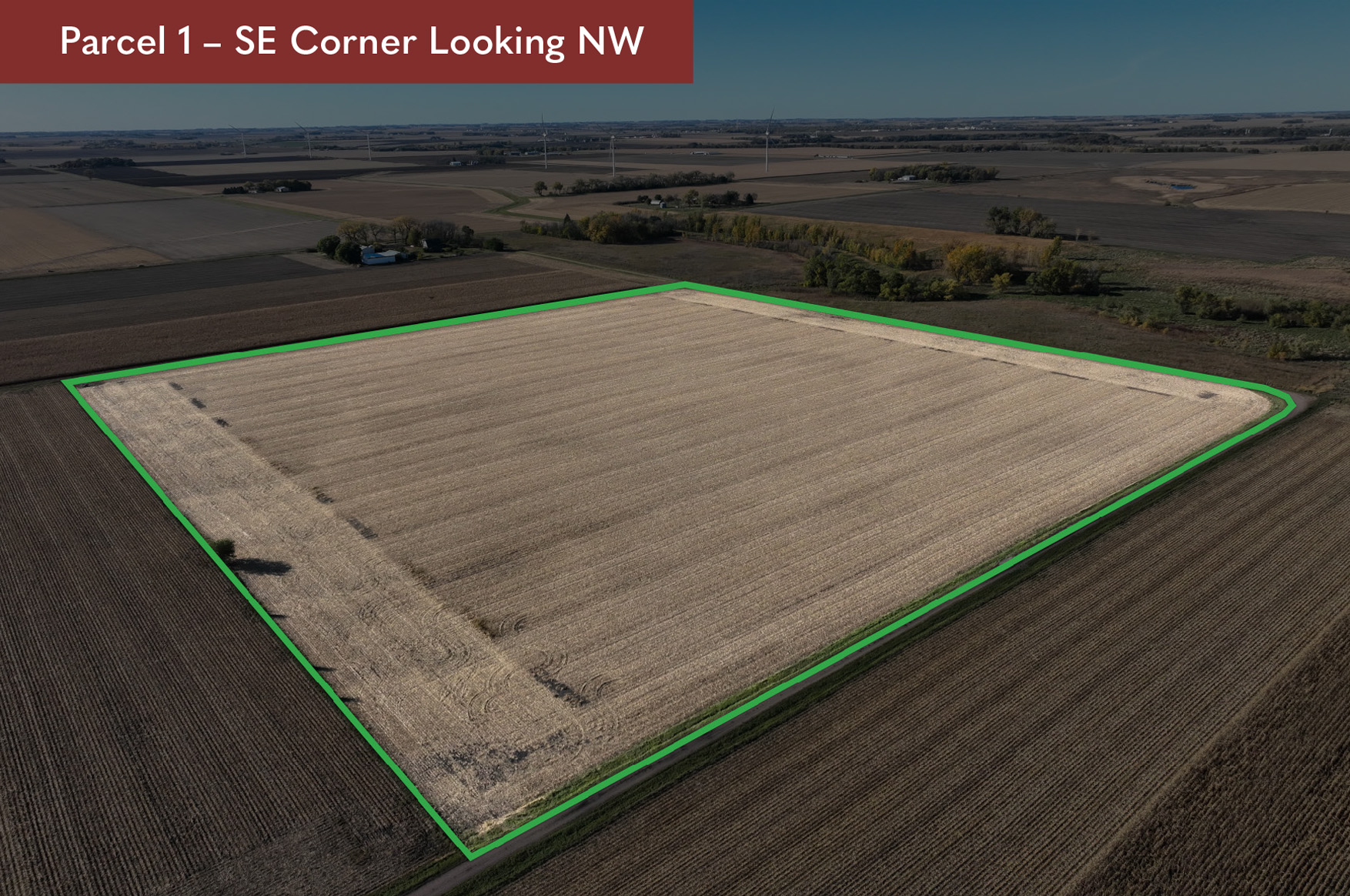
OWNERSHIP: The 40-acre parcel has been in the Rahn family since October 1997.
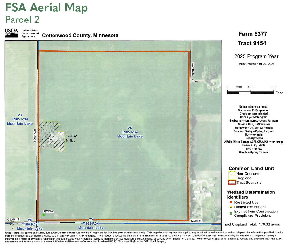
TAX ID #: 120240201 (60 acres) 120240301 (114.07 acres)
REAL ESTATE TAXES: 2025 Ag Non-Homestead Taxes: 120240201 - $3,032.00 2025 Ag Non-Homestead Taxes: 120240301 - $5,768.00 Special Assessment - $0.00 Total Estimated Tax & Specials - $8,800.00
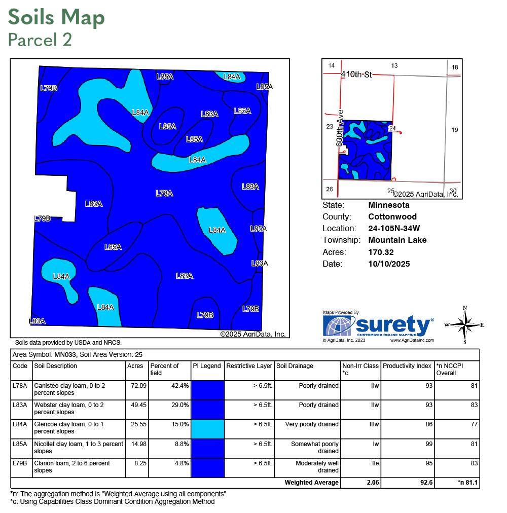
FSA INFORMATION: Total Acres - 174.07± acres FSA Tillable Acres - 168.46± acres* Corn Base Acres - 84.23± acres Corn PLC Yield - 167.00± bushels Soybean Base Acres - 84.23± acres Soybean PLC Yield - 41.00± bushels *After building site tillable reduction. 0.8 acre of existing tillable are within building site property. FSA will have to recalculate base acres after sale.
LAND LEASE & WIND EASEMENT INFORMATION: The Rahn trustees entered into a land lease and wind easement with Geronimo Wind Energy, LLC, in July of 2011. The 2025 payment was $20.00 per acre ($3,460). A copy of the land lease and wind easement, along with accompanying documents, will be furnished upon request.
SOIL DESCRIPTION: Nicollet clay loam, Webster clay loam, Glencoe clay loam, Canisteo clay loam, Clarion loam. See soil map.
CROP PRODUCTIVITY INDEX (CPI): 92.6 CPI
TOPOGRAPHY: Level to slight roll.
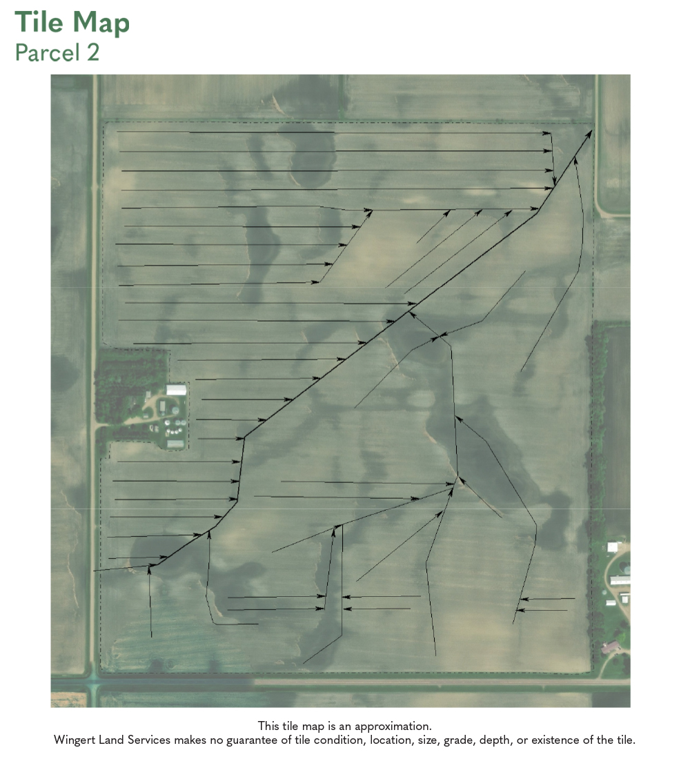
DRAINAGE: Private outlet and mains. Substantial system tiling. See Tile map.
CRP: N/A
NRCS CLASSIFICATION ON TILLABLE ACRES: PC/NW – Prior Converted/No Wetlands NHEL – No Highly Erodible Lands
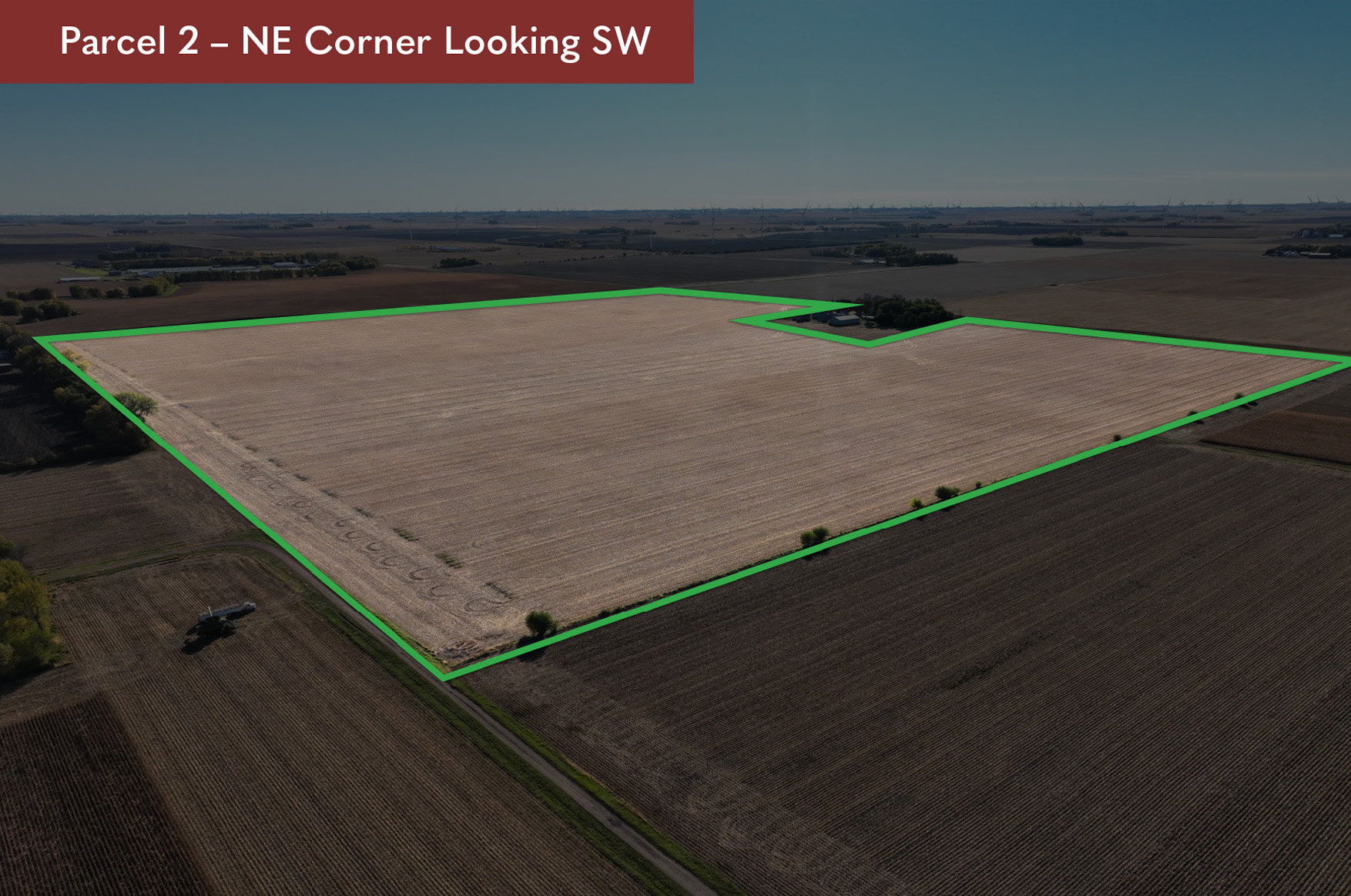
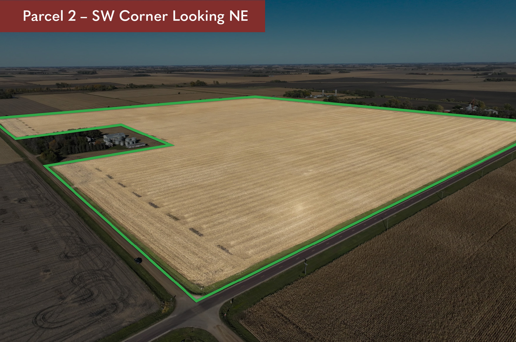
OWNERSHIP: The south 114-acre parcel has been in the Rahn family since January 1921. The north 60-acre parcel has been in the Rahn Family since February 1964.
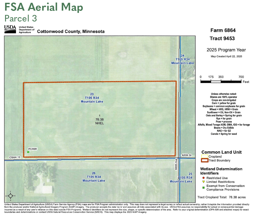
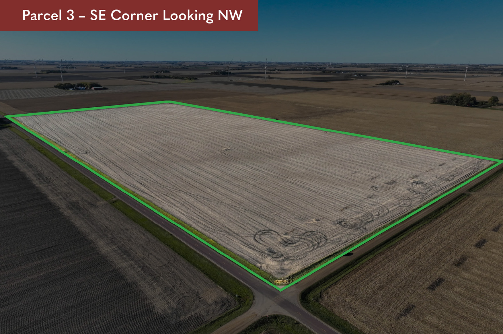
DESCRIPTION:
S1/2 of SE1/4 Section 23, T105N-R34W
(Mountain Lake Township, Cottonwood County)
TAX ID #:
120230700
REAL ESTATE TAXES:
2025 Ag Non-Homestead Taxes - $4,036.00
Special Assessment - $0.00
Total Estimated Tax & Specials - $4,036.00
FSA INFORMATION:
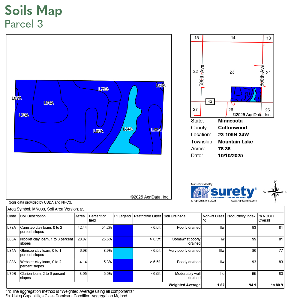
Total Acres - 80.00± acres
FSA Tillable Acres - 78.38± acres
Corn Base Acres - 48.49± acres
Corn PLC Yield - 168.00± bushels
Soybean Base Acres - 29.09± acres
Soybean PLC Yield - 42.00± bushels
LAND LEASE & WIND EASEMENT INFORMATION:
The Rahn trustees entered into a land lease and wind easement with Geronimo Wind Energy, LLC, in July of 2011. The 2025 payment was $20.00 per acre ($1,600). A copy of the land lease and wind easement, along with accompanying documents, will be furnished upon request.
SOIL DESCRIPTION:
Nicollet clay loam, Clarion loam, Webster clay loam, Glencoe clay loam, Canisteo clay loam. See soil map.
CROP PRODUCTIVITY INDEX (CPI):
94.1 CPI
TOPOGRAPHY:
Level to slight roll.
DRAINAGE:
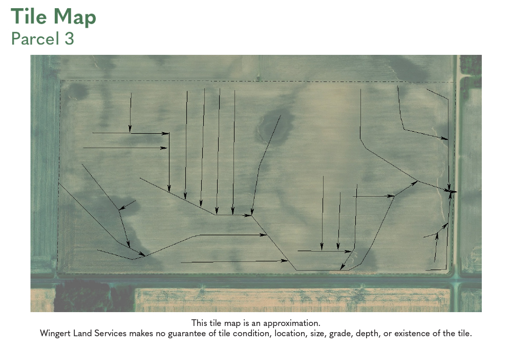
Private outlet and mains. Random laterals and some system tiling. See Tile map.
CRP:
N/A
NRCS CLASSIFICATION ON TILLABLE ACRES:
PC/NW – Prior Converted/No Wetlands
NHEL – No Highly Erodible Lands
OWNERSHIP:
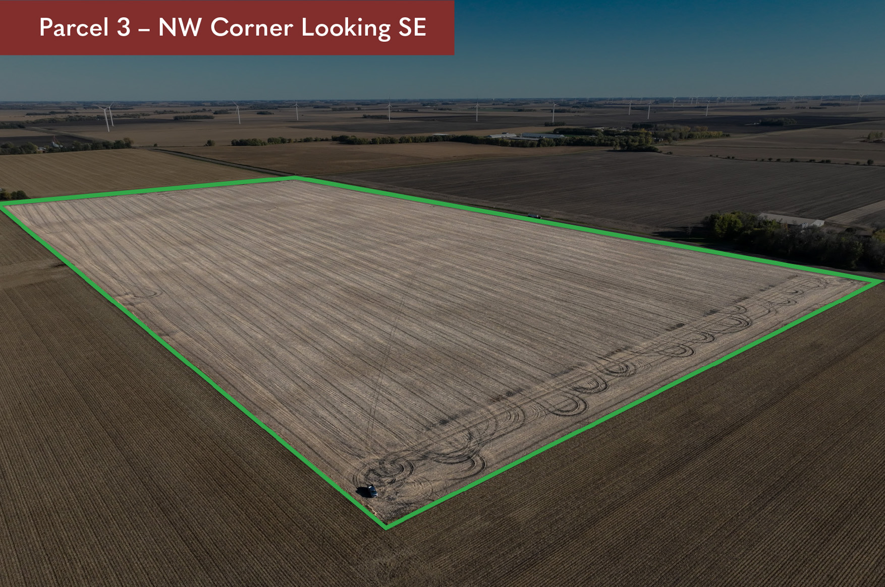
The 80-acre parcel has been in the Rahn family since January 1956.
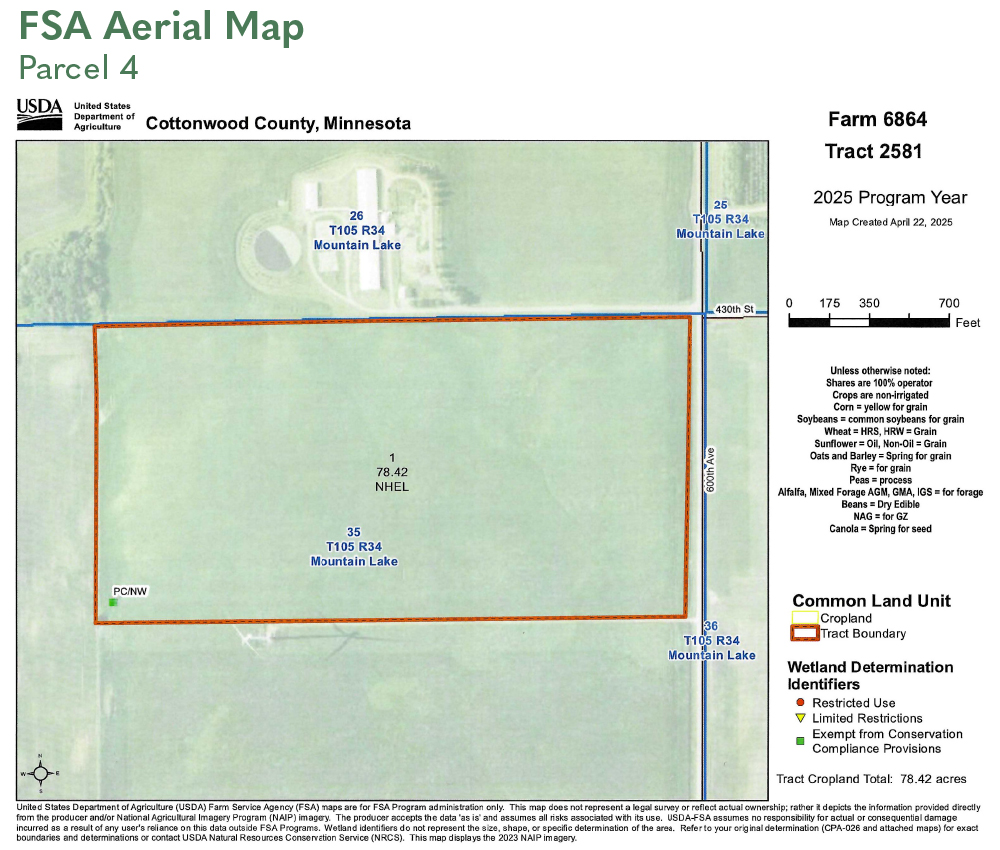
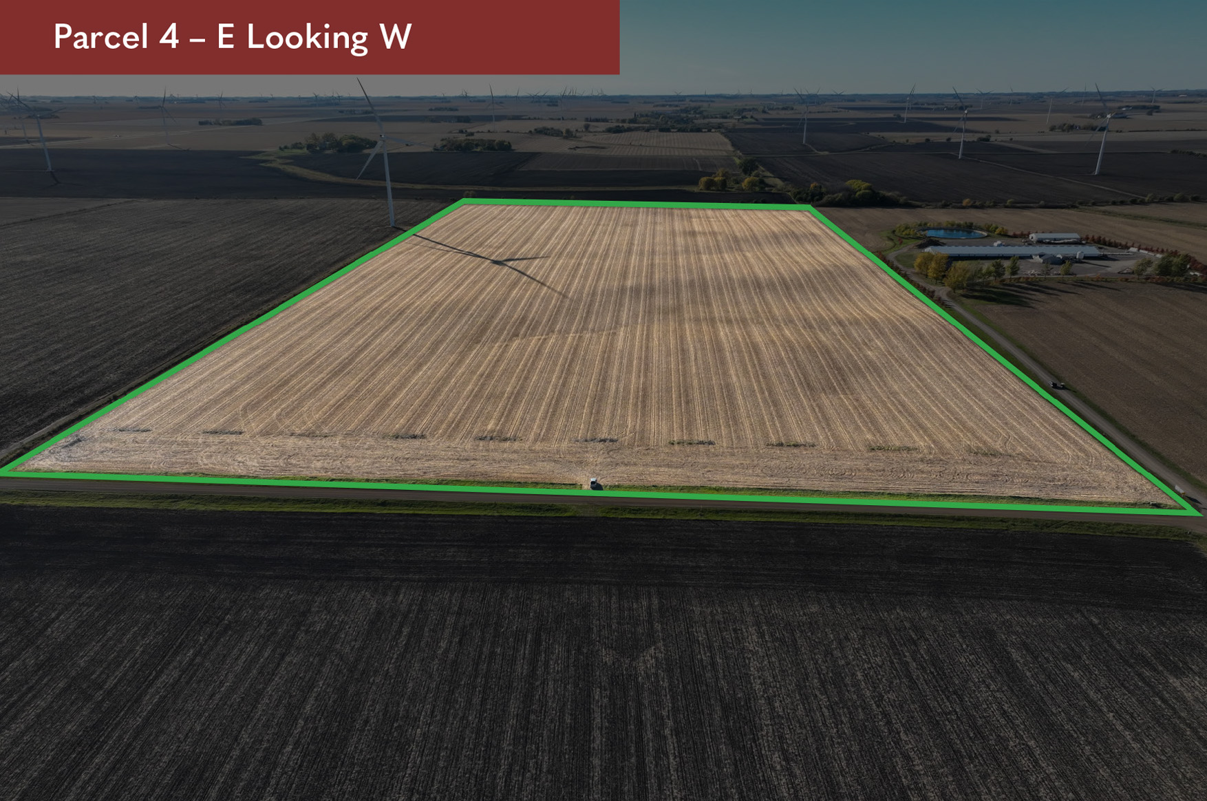
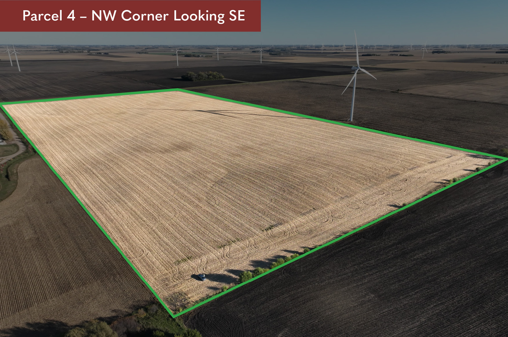
DESCRIPTION:
N1/2 of NE1/4 Section 35, T105N-R34W
(Mountain Lake Township, Cottonwood County)
TAX ID #:
120350100
REAL ESTATE TAXES:
2025 Ag Non-Homestead Taxes - $3,828.00
Special Assessment - $0.00
Total Estimated Tax & Specials - $3,828.00
FSA INFORMATION:
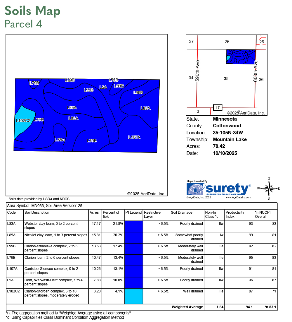
Total Acres - 80.00± acres
FSA Tillable Acres - 78.42± acres
Corn Base Acres - 48.51± acres
Corn PLC Yield - 168.00± bushels
Soybean Base Acres - 29.11± acres
Soybean PLC Yield - 42.00± bushels
LAND LEASE & WIND EASEMENT INFORMATION:
The Rahn trustees entered into a land lease and wind easement with Geronimo Wind Energy, LLC, in July of 2011. The 2025 payment was $20.00 per acre ($1,600). A copy of the land lease and wind easement, along with accompanying documents, will be furnished upon request.
SOIL DESCRIPTION:
Nicollet clay loam, Clarion-Swanlake complex, Clarion loam, Webster clay loam, Canisteo-Glencoe complex, Delft, Calrion-Storden complex. See soil map.
CROP PRODUCTIVITY INDEX (CPI):
94.1 CPI
TOPOGRAPHY:
Level to slight roll.
DRAINAGE:
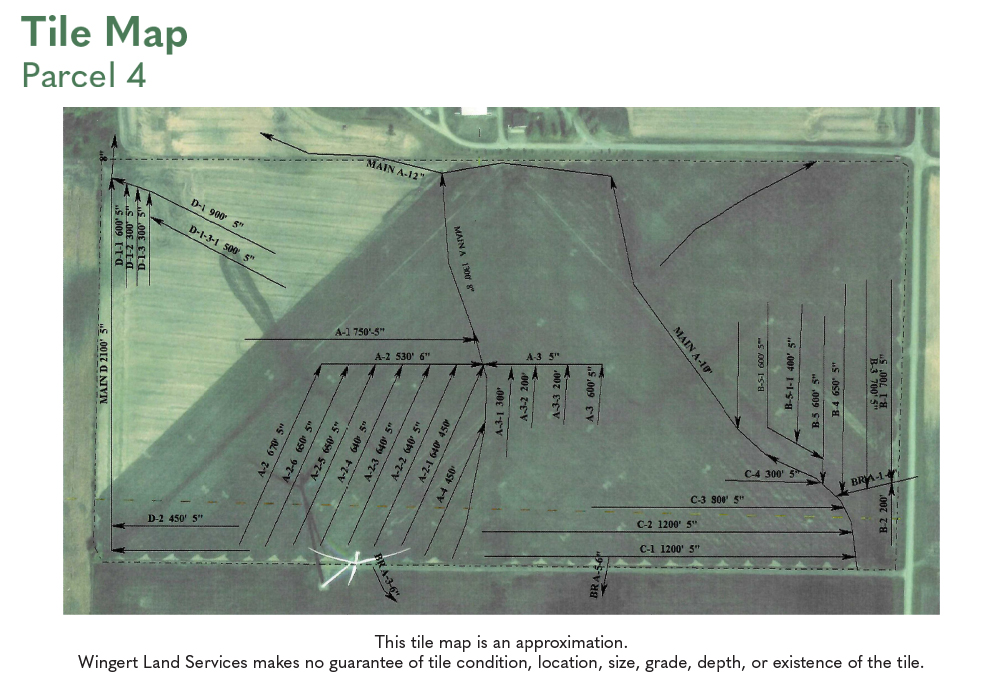
Judicial Ditch 85A (12") and two private outlets (8" and 6"). Random laterals and some system tiling. See Tile map.
CRP:
N/A
NRCS CLASSIFICATION ON TILLABLE ACRES:
PC/NW – Prior Converted/No Wetlands
NHEL – No Highly Erodible Lands
OWNERSHIP:
The 80-acre parcel has been in the Rahn family since February 1982.