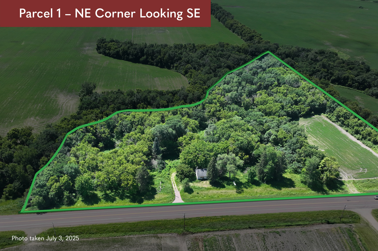
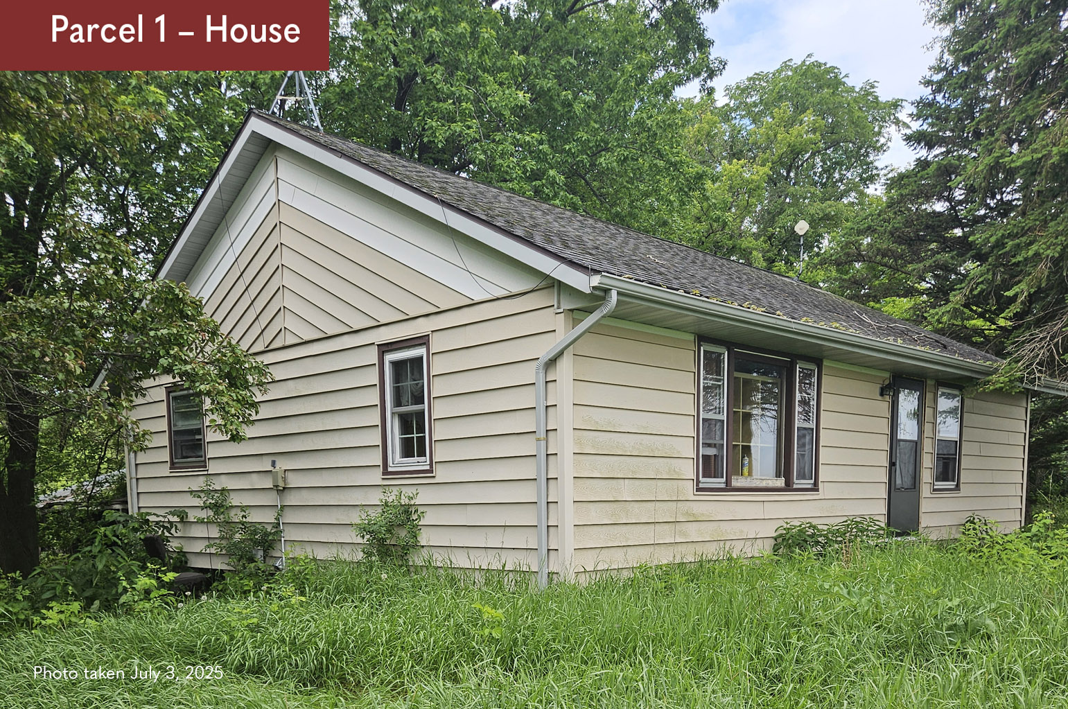
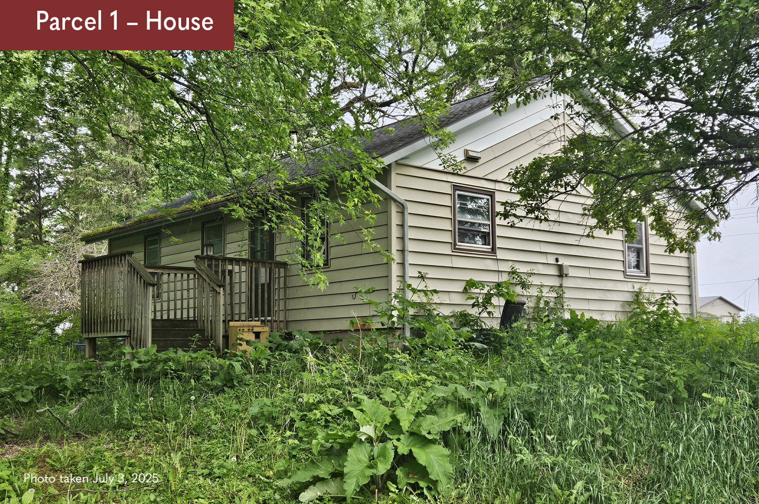
PARCEL 1: 9.88± ACRES
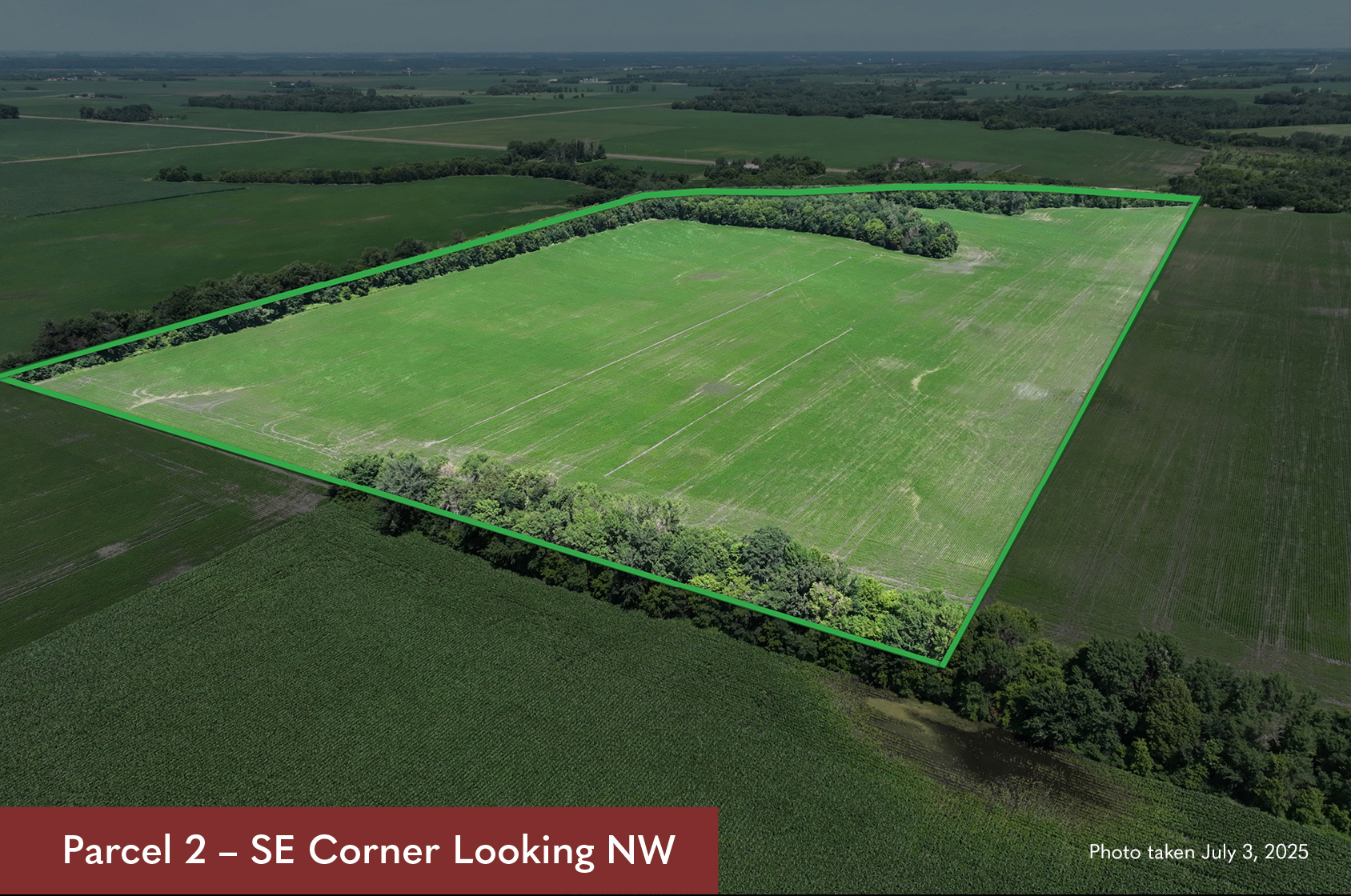
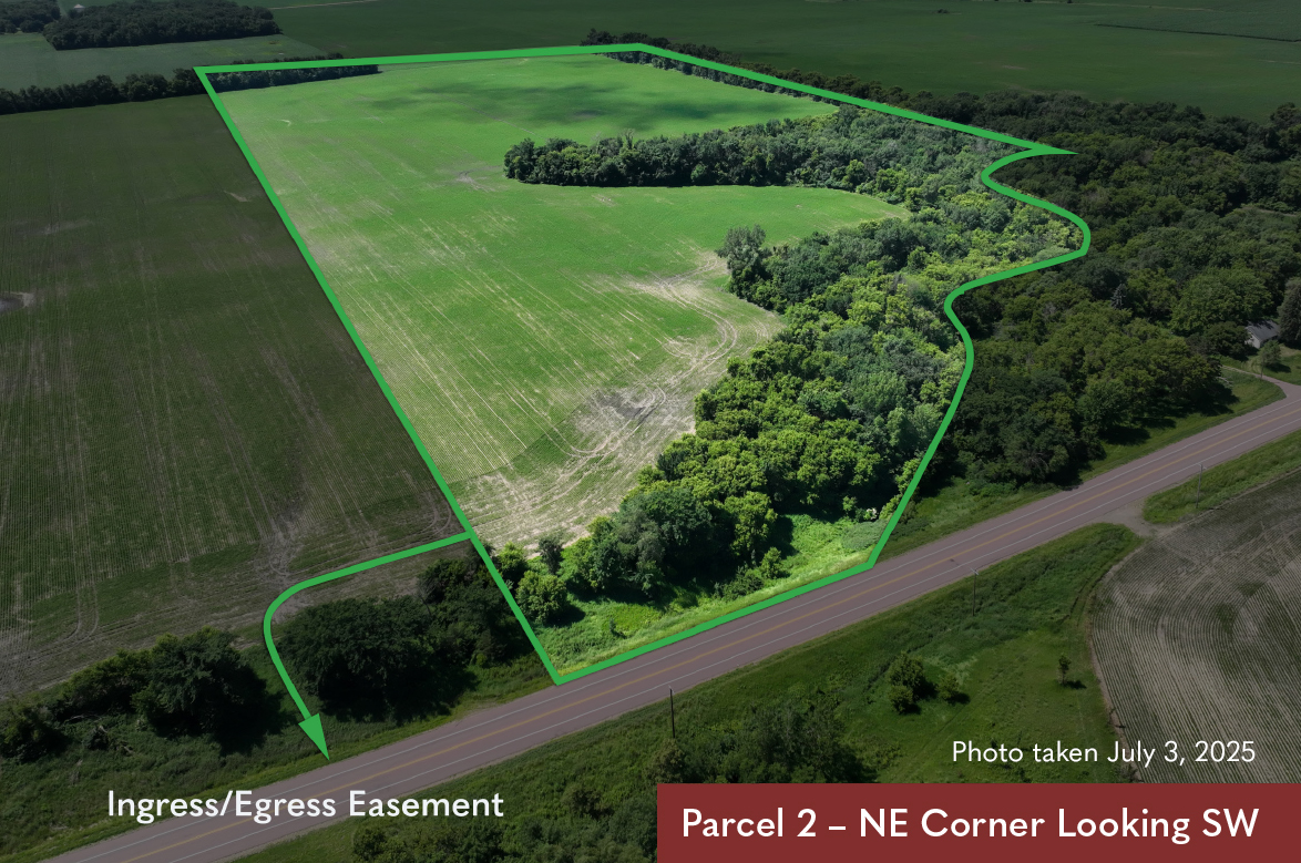
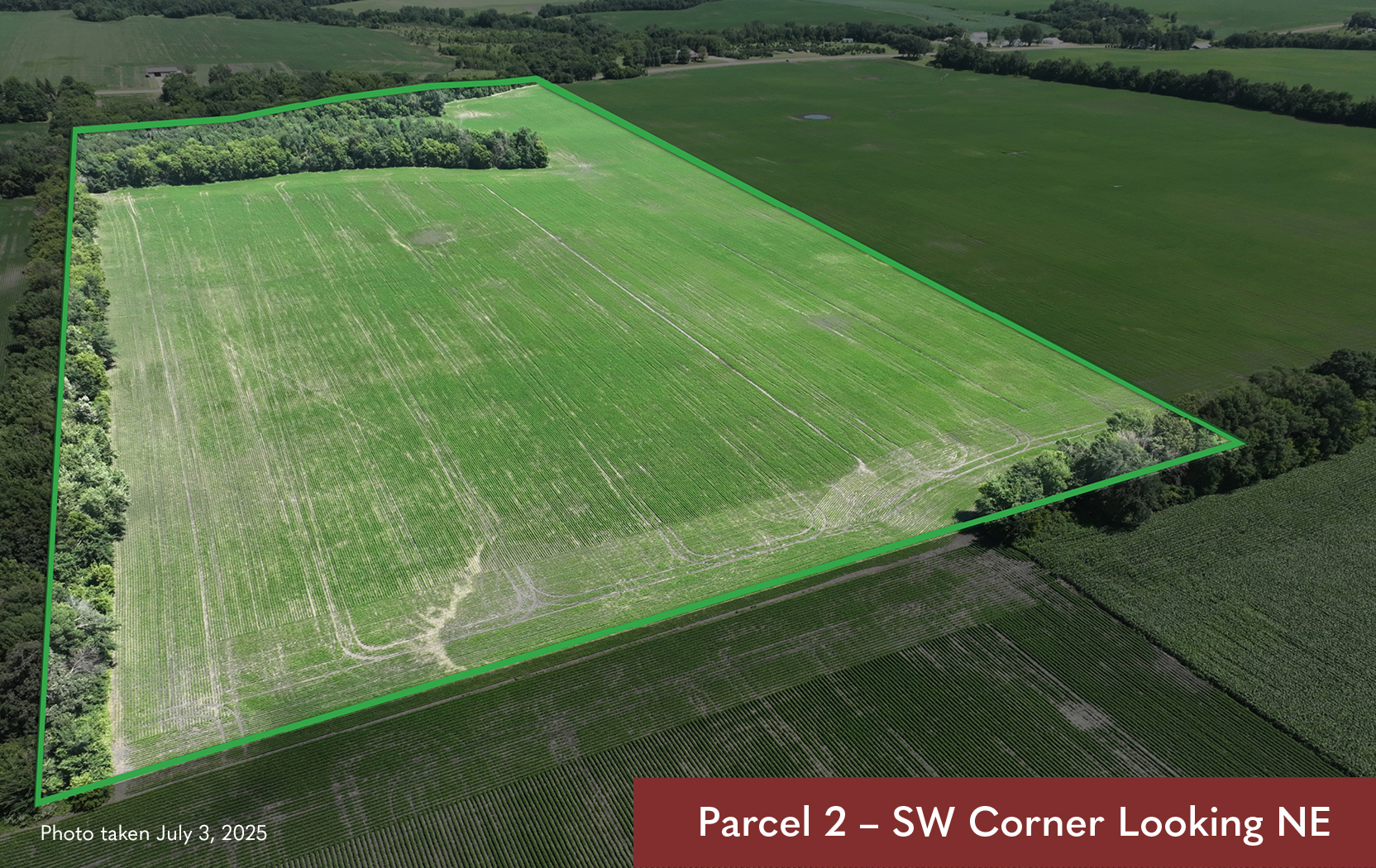
PARCEL 2: 62.90± ACRES
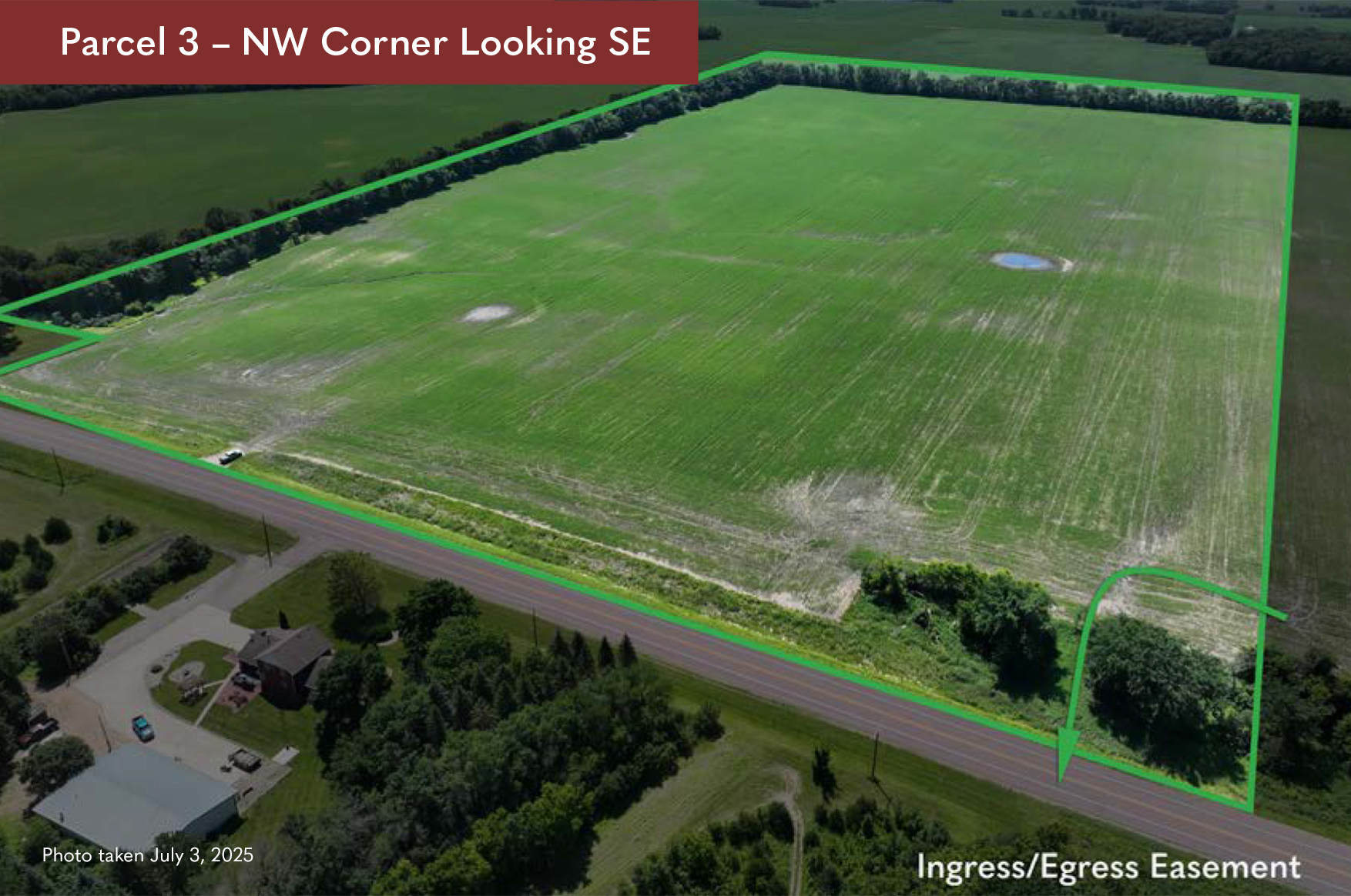
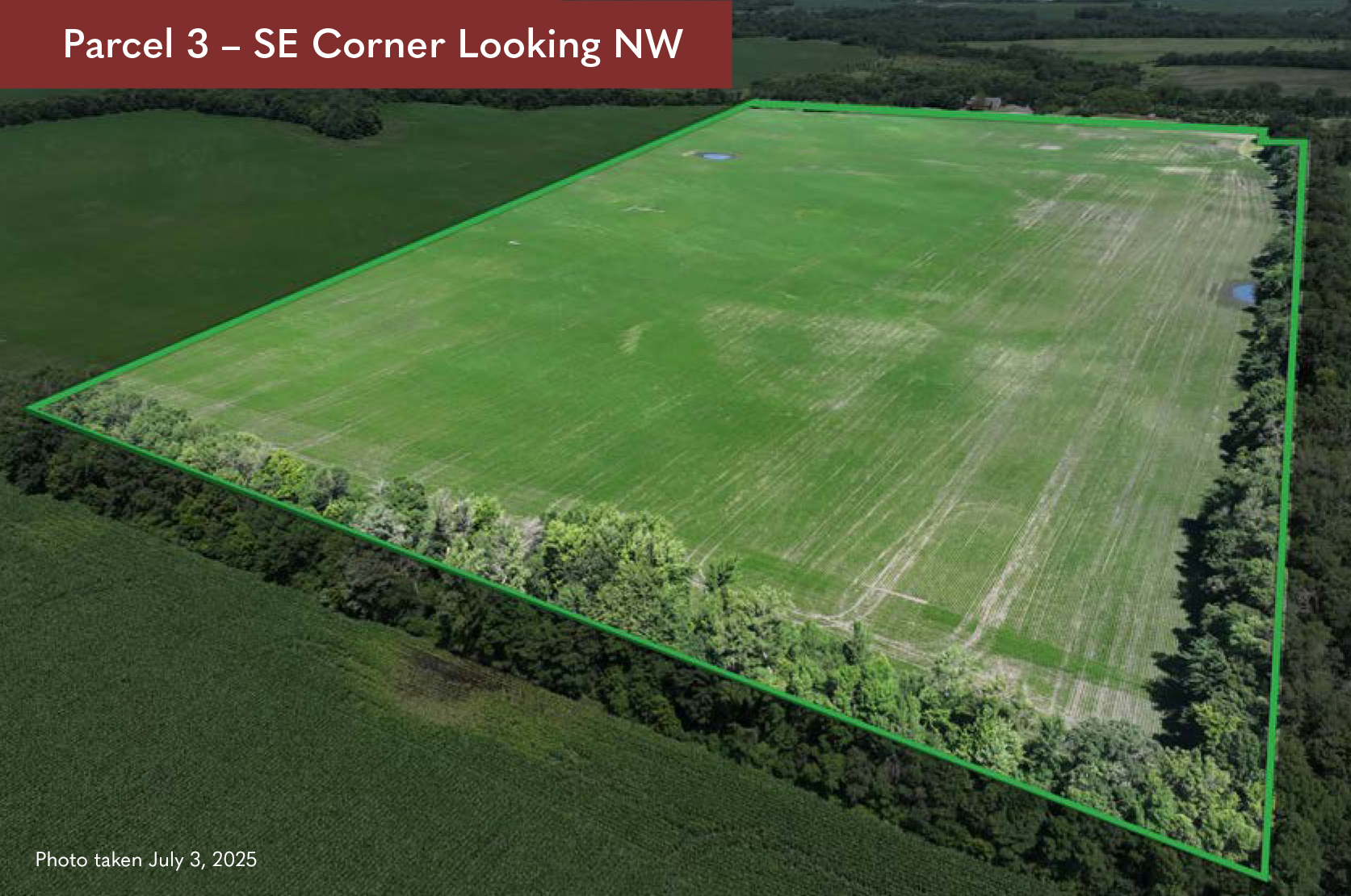
PARCEL 3: 83.85± ACRES
Christensen Family &
Marcelyn Christensen Estate
Sharon Township, Le Sueur County, Minnesota
This property was sold by “Sealed Bid Auction”
Thursday, August 28, 2025 @ 11:00 a.m.
Le Center Sportsman Club
25 East Derrynane Street, Le Center, MN 56057
(located in the Le Sueur County Fairgrounds)
Owners:Christensen Family (Parcel 1 & 2);
Marcelyn Christensen Estate (Parcel 3),
Shirley Nickel, Personal Representative
Attorney: John Christian & Taliesen Burrows
Agent Contact:Chuck Wingert
Phone: 507.381.9790
Email: charles@wingertlandservices.com

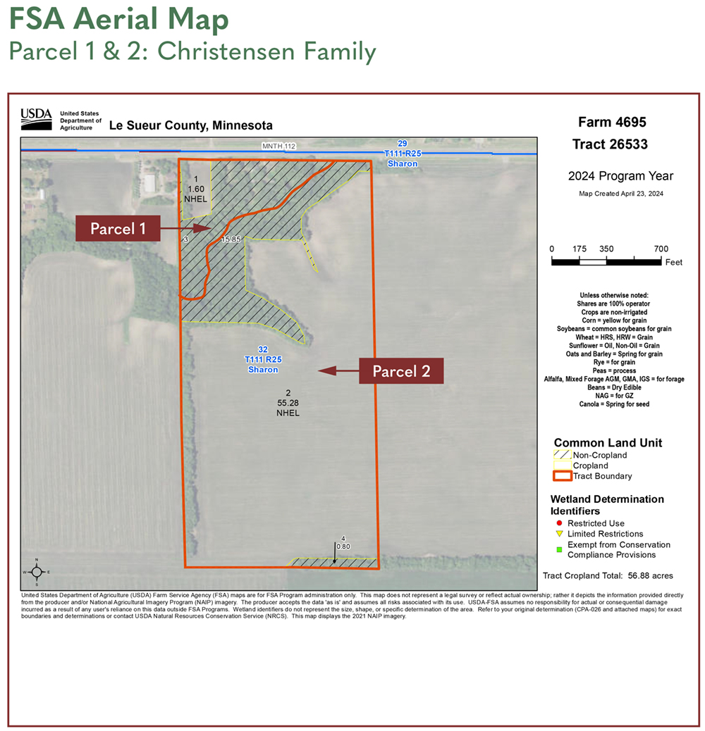
DESCRIPTION:
9.88± acres in NW1/4 of NE1/4 lying north of the centerline of unnamed ravine, Section 32, T111N-R25W. Property to be surveyed if sold as separate parcel.
TAX ID #:
11.032.2600 (included Parcel 1 & Parcel 2)
REAL ESTATE TAXES:
2025 Assessor’s Estimated Ag Non-Homestead Taxes - $2,249.00
Special Assessment - $18.00
Total Estimated Tax & Specials - $2,267.00
FSA INFORMATION:
Total Acres - 9.88± acres
FSA Tillable Acres - 1.6± acres
Corn Base Acres - 0.50± acres
Corn PLC Yield - 160.00± bushels
Soybean Base Acres - 0.50± acres
Soybean PLC Yield - 39.00± bushels
OTHER:
The house is uninhabitable. Seller’s Disclosure Alternatives available upon request. The well was installed in 2011 and updated June 2014.
SOIL DESCRIPTION:
Le Sueur loam, Le Sueur-Lester complex
CROP PRODUCTIVITY INDEX (CPI):
87.4 CPI
TOPOGRAPHY:
Level to Rolling
DRAINAGE:
Surface
CRP:
None
NRCS CLASSIFICATION ON TILLABLE ACRES:
NHEL – Non-Highly Erodible Lands
COURT ORDER:
Parcels 1 and 2 are court-ordered sales. Minimum bid for Parcel 1 is $8,600/acre. Final auction price to be approved by court.
DESCRIPTION:
W1/2 of NE1/4 less E6a, lying south of Parcel 1, Section 32, T111N-R25W. If sold separately from Parcel 1, a survey will be completed to establish the east property line and establish an ingress/egress easement across the northwest corner of Parcel 3.
TAX ID #:
11.032.2600 (included Parcel 1 & Parcel 2)
REAL ESTATE TAXES:
2025 Assessor’s Estimated Ag Non-Homestead Taxes - $3,923.00
Special Assessment - $0.00
Total Estimated Tax & Specials - $3,923.00
FSA INFORMATION:
Total Acres - 62.90± acres
FSA Tillable Acres - 55.25± acres
Corn Base Acres - 28.02± acres
Corn PLC Yield - 160.00± bushels
Soybean Base Acres - 27.73± acres
Soybean PLC Yield - 39.00± bushels
LEASE/RENT INFORMATION:
2025 farm lease and RE taxes will be prorated to the date of closing. Lease information to be provided upon request.
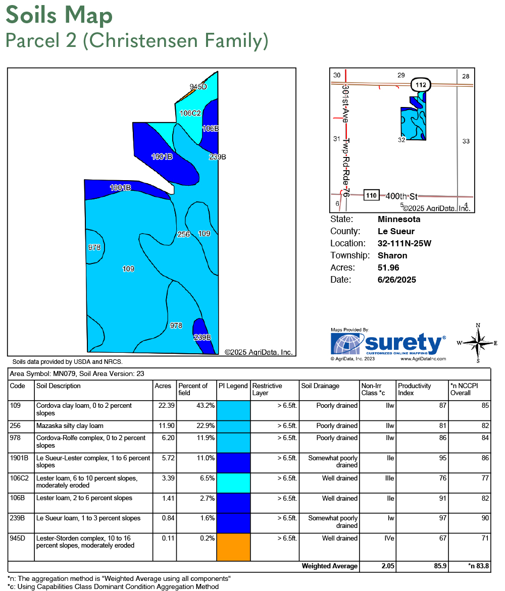
SOIL DESCRIPTION:
Cordova clay loam, Mazaska silty clay loam, Le Sueur loam, Lester loam. Cordova-Rolfe complex. See Soils Map.
CROP PRODUCTIVITY INDEX (CPI):
85.7 CPI
TOPOGRAPHY:
Level to Rolling
DRAINAGE:
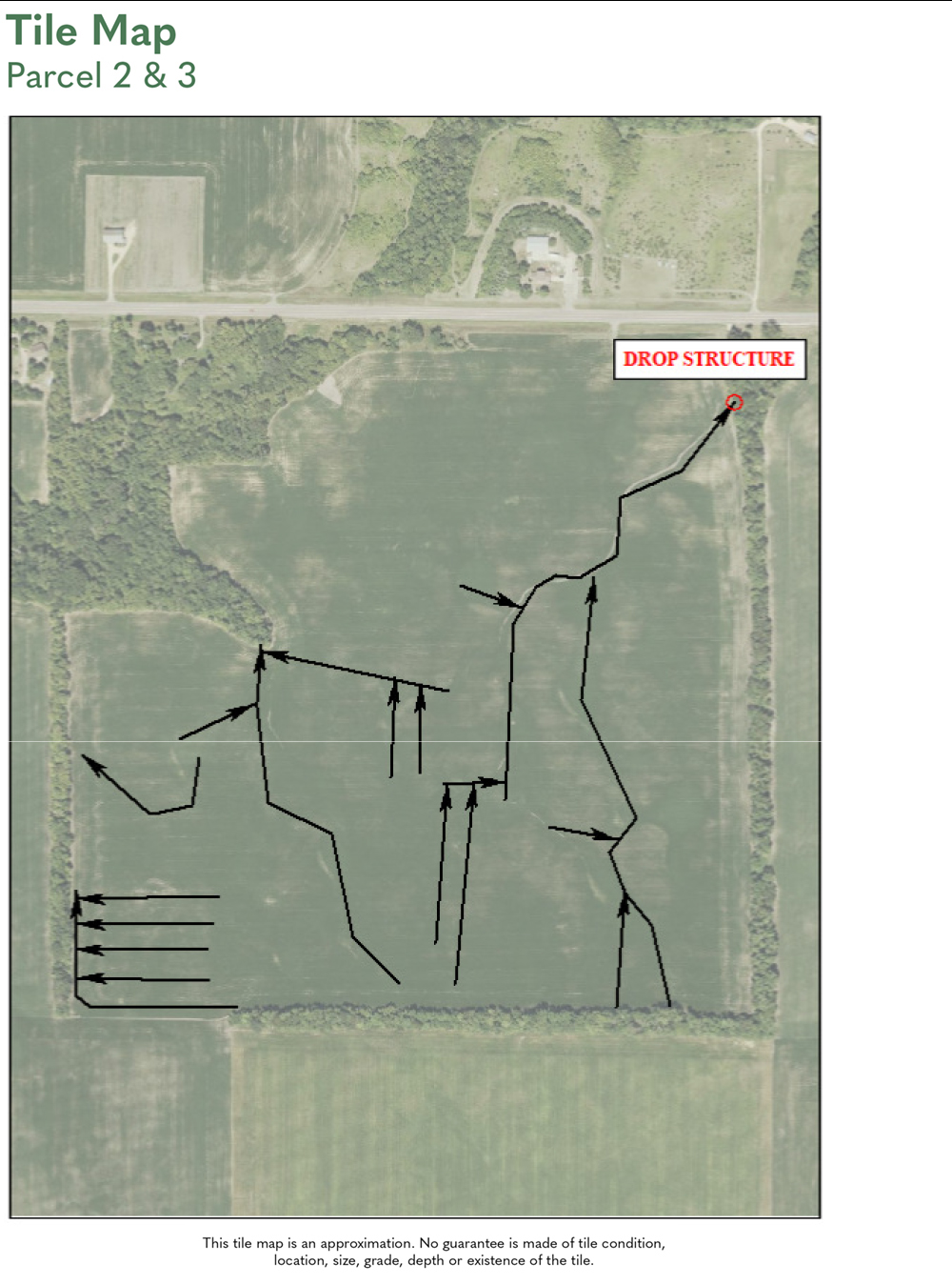
Ravine outlets. Random tile mains and laterals. Note: A drainage agreement will be entered into allowing the northwest watershed from Parcel 3 to be tiled into the ravine on Parcel 2.
CRP:
None
NRCS CLASSIFICATION ON TILLABLE ACRES:
NHEL – Non-Highly Erodible Lands Wetland determination not complete.
ACCESS & SURVEY:
If Parcels 2 and 3 are sold to separate buyers, the property line between the two parcels will be surveyed, and an ingress/egress agreement will be created to allow Parcel 2 to gain access across the northwest area of Parcel 3.
COURT ORDER:
Parcels 1 and 2 are court-ordered sales. Minimum bid for Parcel 2 is $9,900/acre. Final auction price to be approved by court.
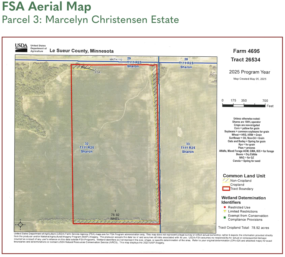
DESCRIPTION:
E1/2 of NE1/4 & E 6 AC of W1/2 of NE1/4, less 1/2 AC to Cemetery in NE corner.
TAX ID #:
11.032.2500
REAL ESTATE TAXES:
2025 Ag Non-Homestead Taxes - $5,564.00
Special Assessment - $0.00
Total Estimated Tax & Specials - $5,564.00
FSA INFORMATION:
Total Acres - 83.85± acres
FSA Tillable Acres - 78.92± acres
Corn Base Acres - 39.58± acres
Corn PLC Yield - 160.00± bushels
Soybean Base Acres - 39.17± acres
Soybean PLC Yield - 39.00± bushels
LEASE/RENT INFORMATION:
2025 lease income to be prorated to the date of closing. Lease information to be provided upon request.
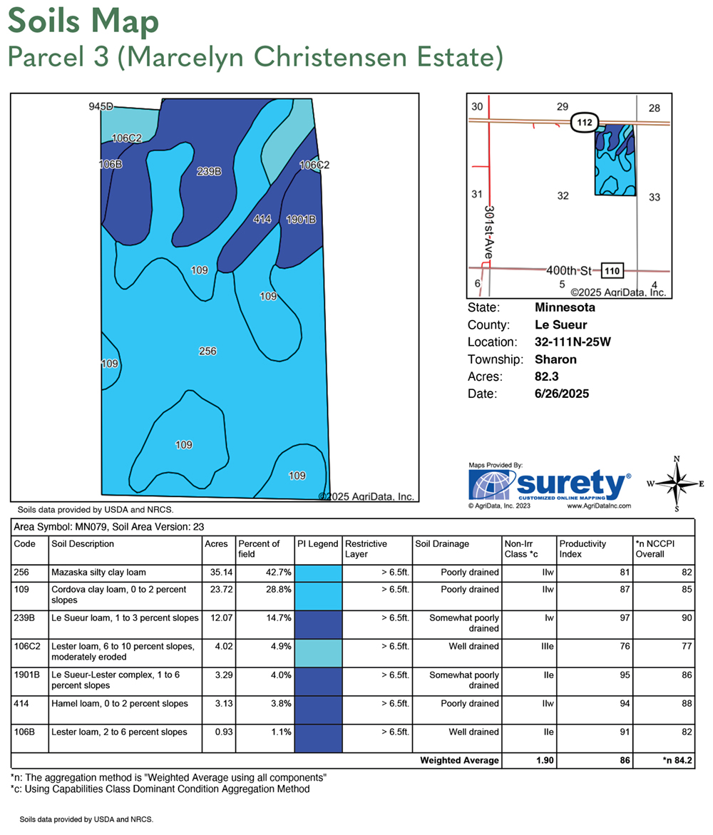
SOIL DESCRIPTION:
Mazaska silty clay loam, Cordova clay loam, Le Sueur loam, Hamel loam, Lester loam. See Soils Map.
CROP PRODUCTIVITY INDEX (CPI):
85.9 CPI
TOPOGRAPHY:
Level to Rolling
DRAINAGE:
Outlet: Drop structure south of cemetery. Private mains and laterals. Note: A drainage agreement will be entered into allowing the northwest watershed from Parcel 3 to be tiled into the ravine on Parcel 2.
CRP:
None
NRCS CLASSIFICATION ON TILLABLE ACRES:
NHEL - Non-Highly Erodible Wetland determination not complete.
ACCESS & SURVEY:
If Parcels 2 and 3 are sold to separate buyers, the property line between the two parcels will be surveyed, and an ingress/egress agreement will be created to allow Parcel 2 to gain access across the northwest area of Parcel 3.