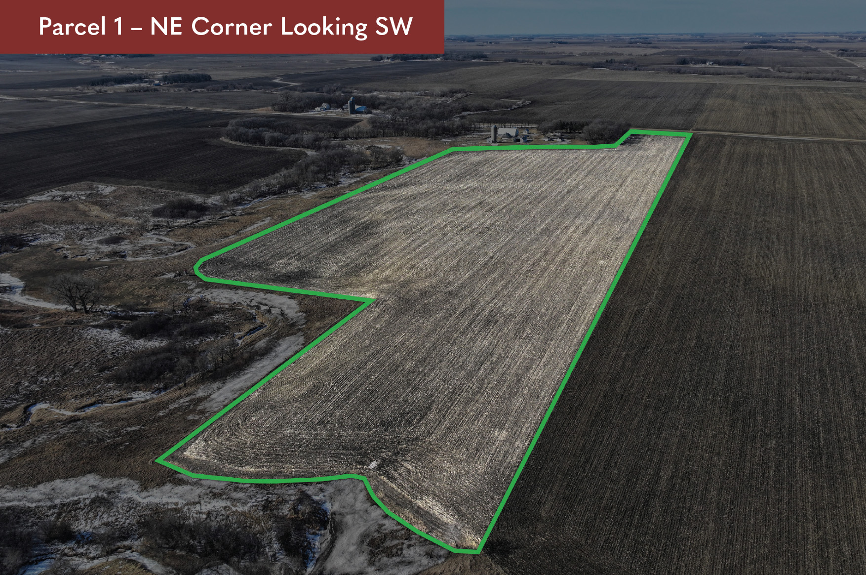
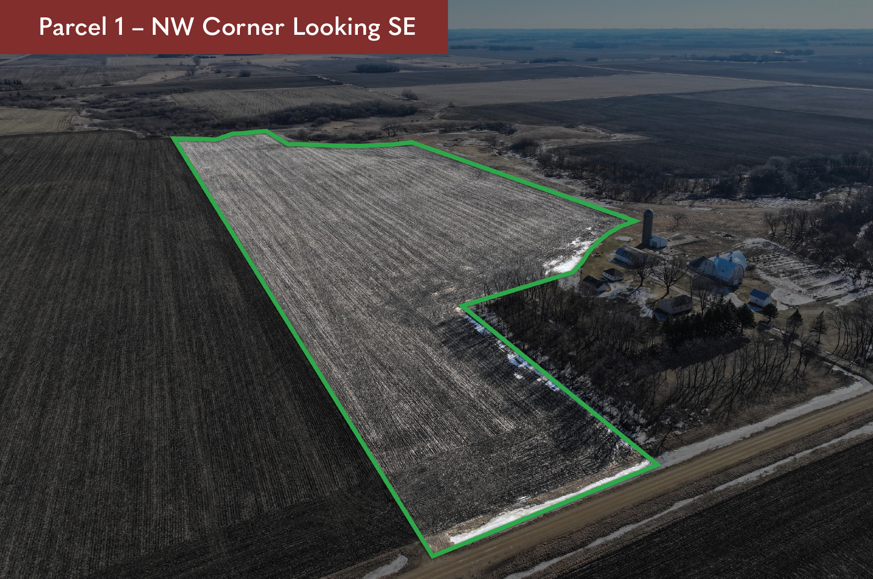
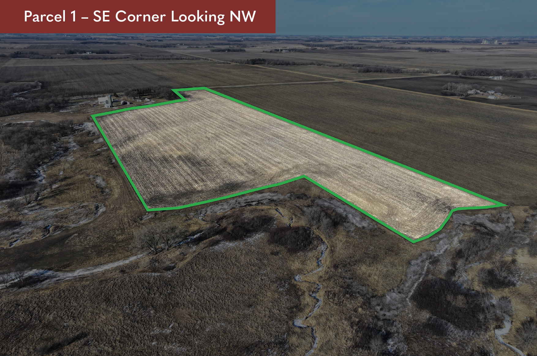
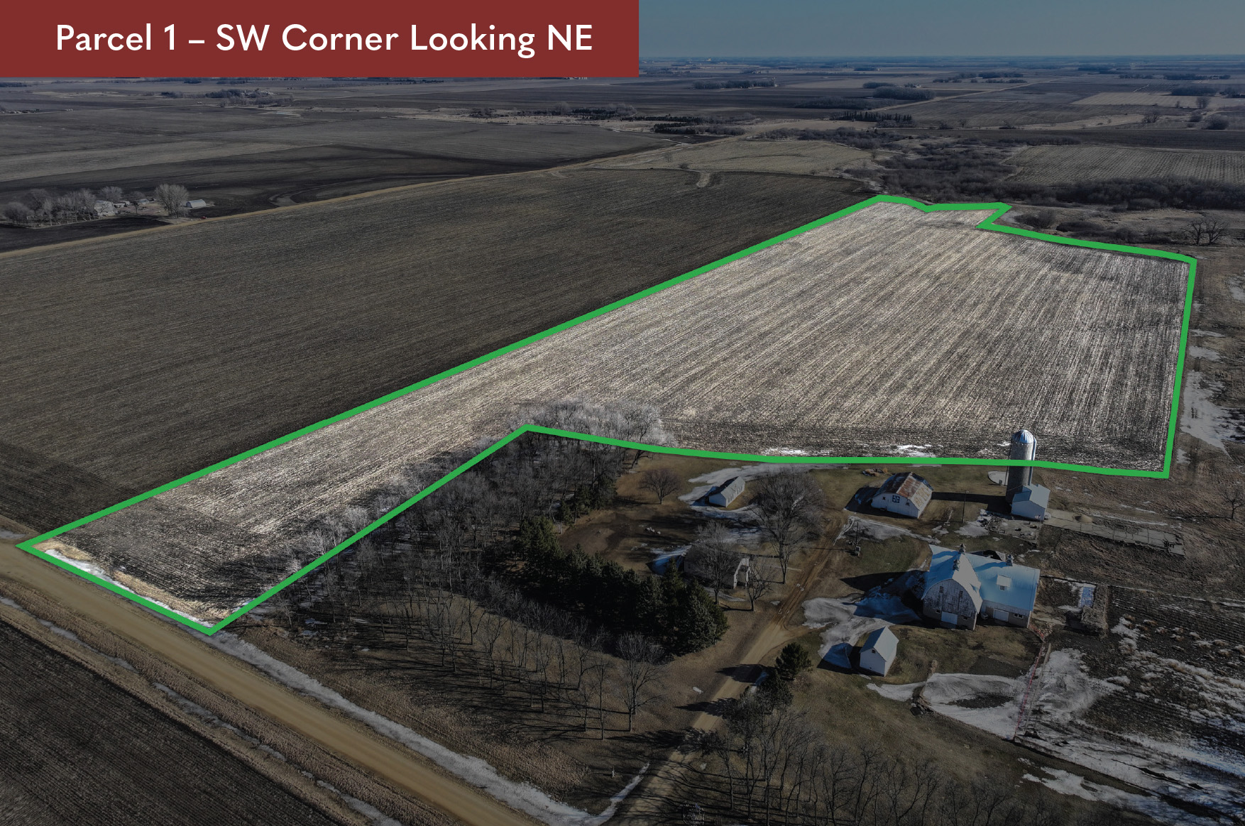
107.50± ACRES
Theodore & Laura Anderson Farms
Ann Township, Cottonwood County, Minnesota
PENDING - PRIVATE SALE
Parcel 1 - $325,000
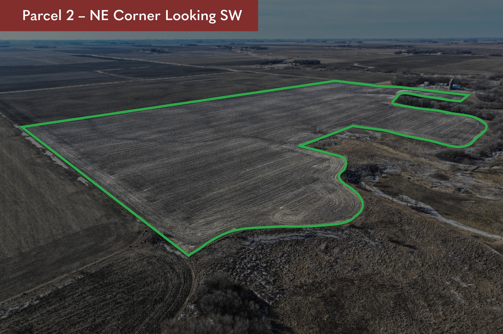
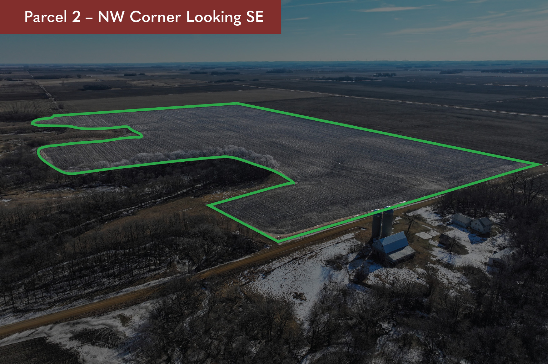
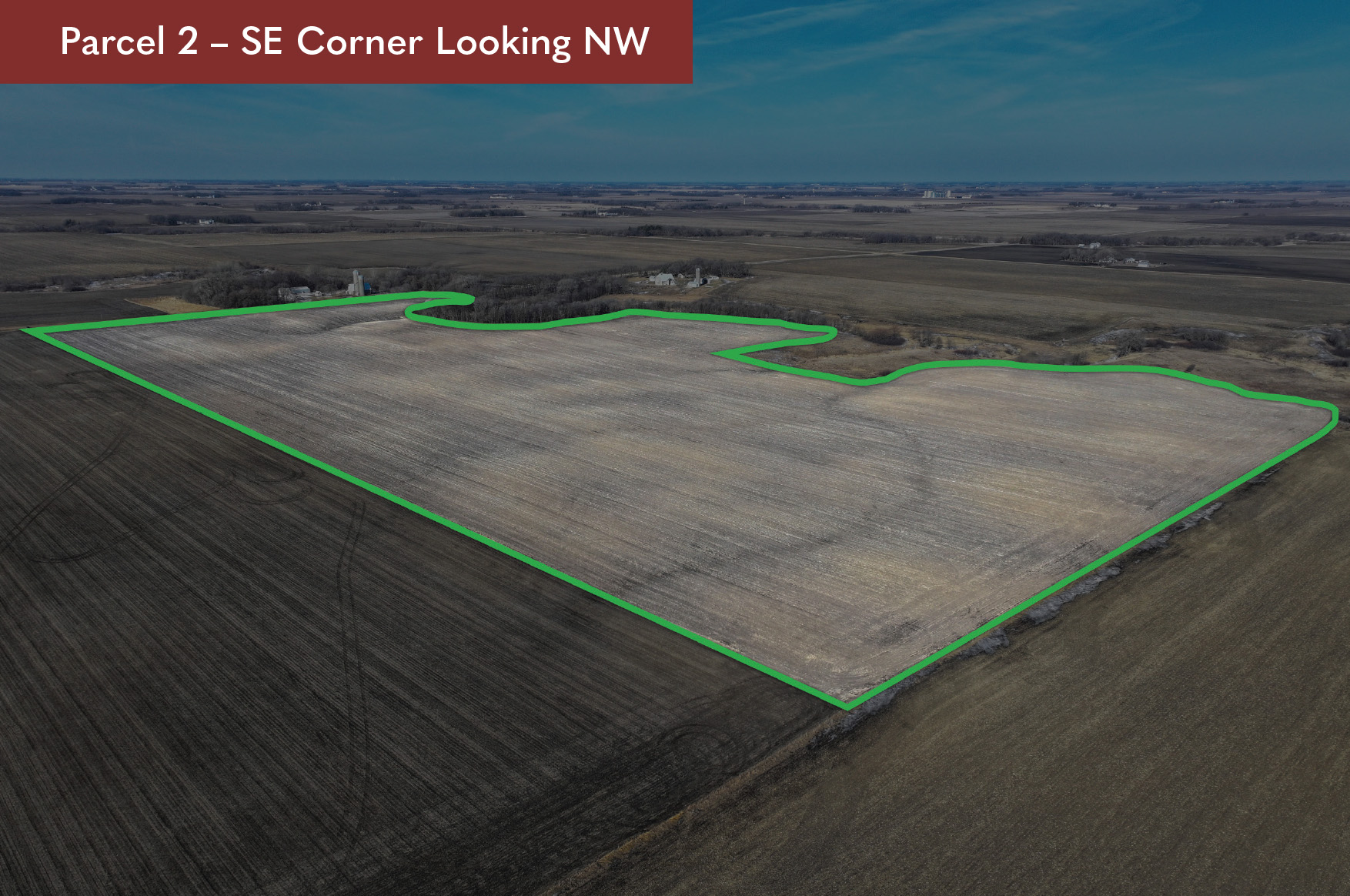
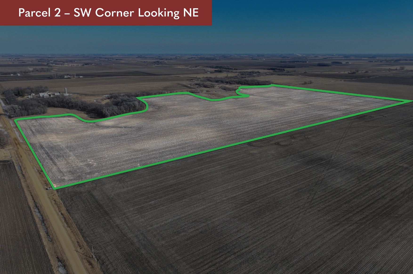
Parcel 2 - $956,250
- Agent Name:
- Geoff Mead
- Agent Phone:
- 507.317.6266
- Agent Email:
- geoff@wingertlandservices.com

DESCRIPTION:
That part of the S 1/2 NW 1/4 Sec 9, Ann Township, See Survey Legal to be provided upon request.
TAX ID #:
03-009-0502
REAL ESTATE TAXES:
Estimated Ag Non-Homestead Taxes - $1,136.00
Special Assessment - $0.00
Total Estimated Tax & Specials - $1,136.00
Taxes are based on 2025 ag non-homestead taxes.
FSA INFORMATION:
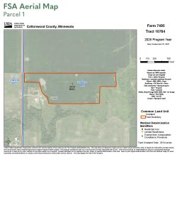
Total Acres - 29.94± acres
FSA Tillable Acres - 29.54± acres
Corn Base Acres - 14.40± acres
Corn PLC Yield - 172.00± bushels
Soybean Base Acres -14.20± acres
Soybean PLC Yield - 50.00± bushels
RENT/LEASE INFORMATION:
Farm is open to farm or lease in 2026.
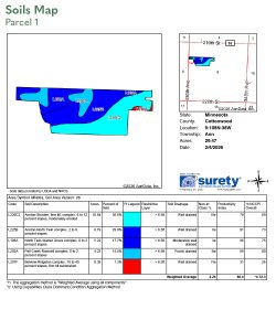
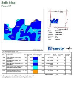
SOIL DESCRIPTION:
Annton-Storden, Annton-North Twin complex, Pell Creek-Romnell complex. See Soils Map.
CROP PRODUCTIVITY INDEX (CPI):
86.4 CPI
TOPOGRAPHY:
Level to rolling.
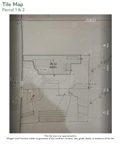
DRAINAGE:
Private mains and laterals with outlet to creek.
CRP:
N/A
NRCS CLASSIFICATION ON TILLABLE ACRES:
PC/NW - Prior Converted/No Wetlands
NHEL - No Highly Erodible Lands
OTHER:
This parcel has been surveyed.
DESCRIPTION:
That part of the N 1/2 SW 1/4 and Part of the S 1/2 NW 1/4 Sec 9, Ann Township, See Survey Legal, to be provided upon request.
TAX ID #:
03-009-0505
REAL ESTATE TAXES:
Estimated Ag Non-Homestead Taxes - $3,796.00
Special Assessment - $0.00
Total Estimated Tax & Specials - $3,796.00
FSA INFORMATION:
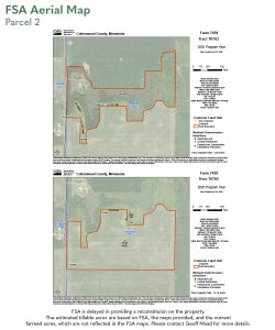
Total Acres - 77.56± acres
FSA Tillable Acres - 76.85± acres
Corn Base Acres - 36.40± acres
Corn PLC Yield - 170.00± bushels
Soybean Base Acres -35.80± acres
Soybean PLC Yield - 50.00± bushels
FSA is delayed in providing a reconstitution on the property. The estimated tillable acres are based on FSA, the maps provided, and the current farmed acres, which are not reflected in the FSA maps. Please contact Geoff Mead for more details.
RENT/LEASE INFORMATION:
Farm is open to farm or lease in 2026.
SOIL DESCRIPTION:
Annton-North Twin complex, Pell Creek-Romnell complex, North Twin-Walnut Grove complex. See Soils Map.
CROP PRODUCTIVITY INDEX (CPI):
90.2 CPI
TOPOGRAPHY:
Level to rolling.
DRAINAGE:
Private mains and laterals with outlet to ravine and creek.
CRP:
N/A
NRCS CLASSIFICATION ON TILLABLE ACRES:
PC/NW - Prior Converted/No Wetlands
NHEL - No Highly Erodible Lands
HEL - Highly Erodible Lands
OTHER:
This parcel has been surveyed.